 Jökulsárlón Glacier Lagoon Boat Tours
Breiðamerkurjökull Glacier: The Tongue That Feeds Jökulsárlón
The Breiðamerkurjökull glacier is the outlet tongue of Vatnajökull that ends in Jökulsárlón. Its retreat since the 1930s created the lagoon, and its calving front is what the boats and kayaks head toward. This guide explains where the ice comes from, how fast it is going, the lagoon it left behind, and the ways to see the glacier wall itself, from the Zodiac near the ice edge to the kayak and hike combo and the winter ice caves. The bookable tours are compared on Jökulsárlón glacier lagoon boat tour.
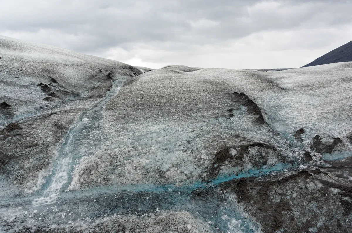
The ridged surface of Breiðamerkurjökull. Photo: Jakub Hałun, CC BY 4.0, via Wikimedia Commons
Quick answer The glacier in brief
Breiðamerkurjökull is an outlet glacier of Vatnajökull that ends in Jökulsárlón and the smaller Breiðárlón. It retreated 5.6 kilometres during the 20th century, measured from 1890, and one source puts the current retreat at roughly 200 metres a year. The lagoon it uncovered now covers about 25 square kilometres.
Key takeaways
- The closest way to the ice edge from the water is the Jökulsárlón Zodiac boat tour, which when conditions allow goes almost all the way up to the glacier.
- To stand on the ice itself, the pick is Glacier Lagoon Kayak and Hike, a 6-hour day with a kayak paddle and a super jeep ride to a hike on Breiðamerkurjökull for $228.87 per person.
- How the retreat made the lagoon, the rates per lobe and what research projects next are covered under How the Glacier Made the Lagoon.
- For every bookable option on the water, start at Jökulsárlón glacier lagoon boat tours.
Breiðamerkurjökull in Figures
The numbers below give the scale of the glacier, its parent ice cap and the lagoon it feeds. Figures come from Wikipedia, the park authority and published research, and where sources disagree both figures are given.
Key Numbers at a Glance
Breiðamerkurjökull is one of about 30 outlet glaciers of Vatnajökull. Vatnajökull covers about 7,700 square kilometres, though another source puts it at 8,100, and holds roughly 3,000 cubic kilometres of ice over about 8 percent of Iceland. The tongue itself ends in two lagoons, Jökulsárlón and Breiðárlón, and its front now sits about 8 kilometres from the ocean edge.
| What | Figure | Source |
|---|---|---|
| Vatnajökull area | about 7,700 km2 (another source says 8,100 km2) | Wikipedia |
| Outlet glaciers on Vatnajökull | about 30, including Breiðamerkurjökull and Fjallsjökull | Wikipedia |
| 20th century retreat of the tongue | 5.6 km, measured from 1890 | Wikipedia |
| Current recession | roughly 200 m a year | Wikipedia |
| Depth of the lagoon at the old snout | about 200 m (another source says 284 m) | Wikipedia |
| Lagoon area today | about 25 km2 | Wikipedia |
| Lagoon area in 1975 | about 8 km2 | Wikipedia |
| Trough carved under one lobe | 200 to 300 m deep | University of Southampton research |
| Valley below the calving front | 25 km long, below sea level | University of Southampton research |
Where the Ice Comes from
Three named ice streams feed the glacier from the ice cap: Esjufjallajökull, Mávabyggðajökull and Norðlingalæðarjökull. Norðlingalæðarjökull is the largest of the three. The mountain Breiðamerkurfjall stands 752 metres high beside the ice, and the Esjufjöll ridges of Vesturbjörg, Skálabjörg, Esjubjörg and Austurbjörg rise within the glacier itself.
The tongue belongs to Öræfajökull in some classifications, where it is counted among that volcano's 14 named outlet glaciers alongside Fjallsjökull, whose lagoon Fjallsárlón lies about 10 kilometres west of Jökulsárlón.
- Vatnajökull average ice thickness is about 380 metres, with a maximum of about 950 metres.
- Its highest point, Hvannadalshnúkur, reaches 2,109.6 metres.
- Jökulsárlón and Fjallsárlón lie on opposite sides of Route 1.
The Name and the Pronunciation
The name Breiðamerkurjökull means Glacier of Wide Woodland. How to pronounce Breiðamerkurjökull is a common search question, but no pronunciation guide is given here. A second question, which glacier lagoon is best in Iceland, has a practical answer on this site: Jökulsárlón is the largest at about 25 square kilometres, while Fjallsárlón, fed by the neighbouring Fjallsjökull tongue, is a quieter alternative described in the Fjallsárlón glacier lagoon guide.
- Settlers who arrived around 900 AD found the glacier front about 20 kilometres further north than today.
- Breiðamerkursandur, the sandur at the ice edge, is mostly sand with vegetation only starting to grow.
How the Glacier Made the Lagoon
Jökulsárlón is a product of retreat. The tongue advanced to near the coast, then pulled back, and the sea filled the hollow it left.
From the Coast to the Present Front
During the Little Ice Age advance, dated 1600 to 1900, the glacier came to within 1 kilometre of the coast. The advance carved a trough 200 to 300 metres deep under one lobe, and the calving terminus now sits at the deepest part of a 25 kilometre long valley below sea level. The glacier retreated 5.6 kilometres during the 20th century, measured from 1890.
Settlers around 900 AD had found the front about 20 kilometres further north, which shows how far the ice advanced between settlement and its Little Ice Age peak.
- Between 1945 and 1998 the glacier front pulled back about 3 km.
- At Skálabjörg, retreat began between 1896 and 1930 with the ice surface lowering 0.8 to 1.3 m a year.
- Six to eight lateral moraine ridges formed on Skálabjörg after the Little Ice Age.
The Lagoon Appears
Jökulsárlón started forming in the 1930s after the glacier began to recede. One source dates the lake's formation to 1933 or 1934, another to 1934 to 1935 after rapid retreat between 1920 and 1965. From that shallow start the lagoon grew fast: about 8 square kilometres in 1975, almost 15 in 1998, 17.5 in 2004, and about 25 square kilometres today.
Its maximum depth is listed as 284 metres, which makes it the deepest lake in Iceland, though Guide to Iceland gives 248. It runs up to 8 kilometres long and its water stays between 0 and 3 degrees Celsius all year. Icebergs that calve from the front float in the deep water for about 5 years before they leave.
- Land around the lagoon rises 2 to 4 cm a year as the ice melts.
- The icebergs show two main colours, milky white and bright blue.
How Fast Each Lobe Moves
The recession rate depends on which part of the front you measure. One widely quoted figure puts the retreat at roughly 200 metres a year. The lobe measurements are lower: the east lobe retreated an average of 28 metres a year from 1980 to 1998, the west lobe typically about 30 metres a year, and the west lobe moved 62.5 metres a year during 1945 to 1965.
The central lobe retreated up to 67 metres a year in earlier periods. The sources do not reconcile the two, so read 200 metres as the headline figure and the lobe rates as measured periods.
- The lagoon grew roughly fourfold from its 1975 extent.
- The rivers on Breiðamerkursandur change their channels often.
The River, the Bridge and the Sea
The lagoon drains to the Atlantic through a short river, today about 500 metres long, that crosses Breiðamerkursandur. The Route 1 bridge over this outlet was built in 1967 and is about 90 metres long. A coffer dam now protects the bridge pillars from iceberg impact, because bergs that drift down the river can reach it.
Research projects what happens next: one model run expects similar retreat for the next 170 years, with the lake growing about 0.5 square kilometres a year. The same model has the glacier leaving the lake after 200 years and nearly gone in 400. If the ice retreats out of the depression, a tidal lagoon of about 80 square kilometres may form.
Warm North Atlantic seawater entering the basin speeds melting and calving at the ice edge, and NASA keeps a Landsat time series of the retreat covering 1985 to 2025.
- The lagoon sits on Breiðamerkursandur in the Hornafjörður municipality.
- The sandur became part of Vatnajökull National Park when the borders were expanded in 2017.
Sources: Wikipedia on Breiðamerkurjökull, Baurley et al. 2020, NASA
Seeing the Glacier Up Close
The ice front is the whole point of the lagoon. Four ways get you close to it, one from the shore for free and three that cost money.
The Zodiac to the Glacier Wall
The Zodiac is the closest you get to the Breiðamerkurjökull front from the water at Jökulsárlón. It covers large areas of the lagoon and gets closer to the icebergs than the amphibian, and when conditions allow it goes almost all the way up to the glacier. One reseller says it runs about 8 kilometres into the lagoon to reach the glacier wall.
The tour costs 16,600 ISK for adults aged 13 and over, which is about $136 at about 122 ISK to the US dollar, and 8,300 ISK, about $68, for children aged 10 to 12. It lasts 1 hour 15 minutes and runs May to October. Children must be at least 10 years old or 130 centimetres tall, and flotation suits are provided.
This site does not sell the Zodiac, so the full breakdown of departures, check-in and pricing sits in the Jökulsárlón Zodiac boat tour guide.
- The operator lists 10 Zodiac departures in high season.
- Weather can affect Zodiac availability and seats are limited, so advance booking is recommended.
- Passengers sit low at water level among the icebergs.
The Kayak and Hike Combination
The only listing here that puts you on the Breiðamerkurjökull ice itself is Glacier Lagoon Kayak and Hike by Troll Expeditions. It costs $228.87 per person and runs 6 hours in a group of up to 9. You paddle among the icebergs on the lagoon, then take a super jeep ride to a hike on Breiðamerkurjökull.
All kayak and glacier gear is provided, but lunch, hotel pickup, bottled water and snacks are not, and participants must be aged 14 to 80. It rates 4.9 from 8 reviews and can be cancelled free up to 24 hours ahead. Meeting points are Troll.is Glacier Lagoon for the hike and Iceguide Jökulsárlón Glacier Kayaking for the paddle, so you drive yourself.
- A short break sits between the kayak and the hike.
- Free cancellation applies 24 hours ahead.
The Kayaks and the Boats on the Lagoon
If you want the paddle without the hike, Jökulsárlón Kayaking Tour by IceGuide Iceland costs $154 for 90 minutes in sit-on-top kayaks, and Small-Group Glacier Lagoon Kayaking costs $149 with no more than 6 per group. Both are meet on site with no transport. The kayak season runs roughly mid May to September, and the IceGuide tour has a minimum age of 14.
Guests get a drysuit, life vest, paddle and kayak, and you must be able to swim. For a boat ride among the bergs, the amphibian (no minimum age) and the Zodiac are compared in detail on the Jökulsárlón glacier lagoon boat tours homepage.
- Commercial boat tours at the lagoon began in 1985.
- About 900,000 people have taken a boat tour at the lagoon since then.
Shore Views That Cost Nothing
Entrance to the lagoon area is free, and the lagoon runs up to 8 kilometres back toward the ice front. The park authority marks four trails on Breiðamerkursandur: B1 Jökulsárlón at 1.2 km and 15 minutes, B2 Eystri-Fellsfjara at 1 km and 40 minutes, B3 Breiðármörk at 15 km and 4 to 5 hours, and B4 Fjallsárlón at 1.5 km and 45 minutes. Rangers can be reached on 842 4355 and the Höfn park office on 575 8400 from 8 to 16.
Overnight stays are not permitted on the sandur, and in winter reindeer herds cross the roads, so drivers should take care. Flush toilets stand at both Jökulsárlón and Fjallsárlón.
- The sandur is an important breeding ground for Arctic tern and great skua.
- Barnacle geese and red-throated divers breed there too.
- Great skuas dive at people who approach their nests.
Sources: icelagoon.is, Vatnajökull National Park
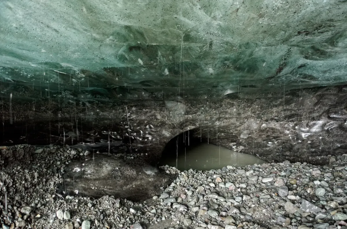
An ice cave opens at the edge of Breiðamerkurjökull. Photo: Jakub Hałun, CC BY 4.0, via Wikimedia Commons
Ice Caves in Winter
The same glacier that calves into the lagoon opens blue ice caves in the cold months, and tours run to them from Jökulsárlón.
What the Ice Cave Tours Cover
Ice cave tours leave from Jökulsárlón Glacier Lagoon, and one listing runs October to April. Guides supply helmets and crampons, so you bring warm layers and nothing technical. The caves are weather dependent and only open in freezing conditions without rain, and tours are confirmed the day before, which means you should keep plans flexible.
February is called the safest ice cave month. One operator at neighbouring Fjallsárlón sells its Vatnajökull Premium Ice Cave Tour for 19,425 ISK, about $159, for 3 to 3.5 hours from November to March, with a private version at 220,000 ISK, about $1803, for 3 to 4 hours from November to April.
- Ice cave tours in depth are not covered on this site.
- The Jökulsárlón boat season is covered under when the boats run on the homepage.
Sources: Guide to Iceland, fjallsarlon.is
Frequently Asked Questions
What is the Breiðamerkurjökull glacier?
It is an outlet glacier of Vatnajökull and it ends in two lagoons, Jökulsárlón and the smaller Breiðárlón. Three ice streams feed it, and its front retreated 5.6 kilometres during the 20th century. The Fjallsárlón glacier lagoon guide covers the neighbouring tongue that ends one lagoon west.
How fast is Breiðamerkurjökull retreating?
One source puts the retreat at roughly 200 metres a year. The lobe measurements are lower, with the east lobe at 28 metres a year from 1980 to 1998 and the west lobe about 30 metres a year. Over the 20th century the front gave up 5.6 kilometres. The modelled future is set out under How the Glacier Made the Lagoon.
How do you get close to the Breiðamerkurjökull glacier wall?
The Zodiac is the closest option from the water, since when conditions allow it goes almost all the way up to the glacier after a run that one reseller puts at about 8 kilometres into the lagoon. Adults pay 16,600 ISK, about $136, and it lasts 1 hour 15 minutes. Details sit in the Jökulsárlón Zodiac boat tour guide.
Can you hike on Breiðamerkurjökull?
Yes, through Glacier Lagoon Kayak and Hike, which costs $228.87 per person and runs 6 hours in a group of up to 9. It pairs a kayak paddle on the lagoon with a super jeep ride to a hike on the glacier, with all gear provided and a minimum age of 14.
How do you pronounce Breiðamerkurjökull?
No pronunciation guide is given here. What is stated is the meaning: the name translates as Glacier of Wide Woodland. More on the name and the ice streams that feed it is under Breiðamerkurjökull in Figures.
Are there ice caves in Breiðamerkurjökull?
Yes, ice cave tours leave from Jökulsárlón Glacier Lagoon and one listing runs October to April, with guides supplying helmets and crampons. The caves only open in freezing conditions without rain and tours are confirmed the day before. February is called the safest month, and the season detail is under Ice Caves in Winter.